


Map of Ha Long Bay: The Ultimate Guide for Navigating Vietnam's Natural Wonder
Ha Long Bay, a UNESCO World Heritage site, stands as one of Vietnam's most magnificent natural wonders. With its complex geography featuring thousands of limestone islands, countless caves, and intricate waterways, having a reliable map becomes essential for any visitor hoping to explore this aquatic labyrinth effectively. This comprehensive guide will help you understand the various types of Ha Long Bay maps available and how to use them to enhance your journey through this breathtaking seascape.
Understanding the Geography of Ha Long Bay
Before diving into the specifics of Ha Long Bay maps, it's important to grasp the geographical context of this remarkable area. Located in northeastern Vietnam, Ha Long Bay is situated approximately 160-180 kilometers from Hanoi in Quang Ninh Province. The bay spans an impressive area of around 1,553 square kilometers and is home to between 1,600 and 1,969 limestone islands and islets of various sizes.

Get familiar with Ha Long Bay’s vast size, limestone islands, and surrounding regions to better understand its layout - Photo Source: Facebook Vịnh Hạ Long Quảng Ninh - Thiên Đường Cảnh Vịnh
This vast aquatic landscape doesn't exist in isolation. Ha Long Bay has important geographical relationships with nearby areas, including Bai Tu Long Bay to the northeast and Cat Ba Island to the southwest. These connections are often highlighted on comprehensive regional maps, offering visitors a broader perspective of this expansive coastal wonder.
The sheer scale of Ha Long Bay—with its thousands of islands spread across over 1,500 square kilometers—underscores why different types of specialized maps have been developed to help travelers navigate this complex natural formation.
General Maps of Ha Long Bay
General maps of Ha Long Bay typically serve as orientation tools, providing an overview of the bay's expansive layout and its position relative to surrounding areas. These maps often highlight:
-
The overall shape and boundaries of Ha Long Bay
-
Its location within Quang Ninh Province
-
The relationship to nearby geographical features like Bai Tu Long Bay and Cat Ba Island
-
Major access points including Halong City and the cruise ports
-
The density of limestone formations across different areas of the bay
General maps are particularly useful for first-time visitors seeking to understand the broader context of Ha Long Bay. They provide a "big picture" view that helps travelers appreciate the scale and complexity of this natural wonder before zooming in on specific areas of interest.
General maps provide an overview of the bay’s layout, boundaries, and key geographical connections - Photo Source: Facebook Vịnh Hạ Long Quảng Ninh - Thiên Đường Cảnh Vịnh
Many general maps include shaded relief features that illustrate the unique karst landscape, giving viewers a sense of the dramatic topography that makes Ha Long Bay so visually stunning. These maps serve as an excellent starting point for planning, allowing visitors to gain spatial awareness before consulting more specialized maps for detailed activities.
Tourist Maps of Ha Long Bay: Key Attractions and Visitor Information
Tourist maps of Ha Long Bay are perhaps the most common type available, designed specifically to highlight popular destinations and points of interest. These maps typically feature:
Major Attractions
The following key destinations appear consistently across various tourist maps:
-
Sung Sot Cave (Surprise Cave): Often described as the largest and most magnificent cave in Ha Long Bay, famous for its stunning stalactites and stalagmites
-
Ti Top Island: A popular island featuring a beach and a panoramic viewpoint accessible via a climb up 427 steps
-
Dau Go Cave: An impressive three-chamber cave with remarkable rock formations, Dau Go Cave History is one of the factors that make this place so unique and special.
-
Thien Cung Cave (Heavenly Palace Cave): Known for its celestial beauty and cathedral-like chamber
-
Bai Chay Area: A prominent beachfront district with numerous tourism facilities
-
Tuan Chau Island: A developed island serving as a major gateway to Ha Long Bay, featuring resorts and entertainment facilities
-
Cua Van Floating Village: One of the traditional floating fishing villages providing insight into local life
Tourist maps highlight must-see attractions, facilities, and suggested itineraries for visitors - Photo Source: Facebook Vịnh Hạ Long Quảng Ninh - Thiên Đường Cảnh Vịnh
Map Features
Quality tourist maps incorporate helpful elements such as:
-
Brief descriptions of major attractions
-
Estimated travel times between key points
-
Symbols indicating facilities like restrooms, refreshments, or ticket offices
-
Color-coding to distinguish between different types of attractions (caves, beaches, villages)
-
Legend explaining the various symbols and notations
-
Scale indicator to help gauge distances
Tourist maps of Ha Long Bay serve as invaluable planning tools, enabling visitors to prioritize attractions based on their interests and create efficient itineraries. The consistent appearance of certain locations across different maps—like Sung Sot Cave and Ti Top Island—confirms their status as essential experiences for most Ha Long Bay visitors.
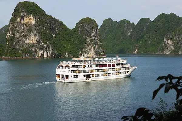
Cruise Route Maps: Popular Journeys and Stopping Points
Given that cruising is the primary way to experience Ha Long Bay, specialized cruise route maps have been developed to illustrate common sailing itineraries and highlight the typical stopping points along these journeys.
Common Cruise Routes
Cruise route maps typically illustrate several standard itineraries:
-
Day cruises: Usually covering the central area of Ha Long Bay with 2-3 stops at major attractions
-
Overnight cruises: More extensive routes that venture further into the bay, often including sunset and sunrise viewing locations
-
2-3 night extended cruises: Comprehensive routes that may include visits to Bai Tu Long Bay or Lan Ha Bay for a more diverse experience
Cruise route maps detail different itineraries and major stops based on cruise duration and visitor interests - Photo Source: Facebook Vịnh Hạ Long Quảng Ninh - Thiên Đường Cảnh Vịnh
Key Stopping Points
Popular stops frequently marked on cruise maps include:
-
Sung Sot Cave
-
Ti Top Island
-
Cua Van Floating Village
-
Luon Cave
-
Ba Trai Dao Islands
-
Tung Sau Pearl Farm
-
Lan Ha Bay (for longer cruises)
-
Various swimming and kayaking spots
Cruise Ports
Critical infrastructure highlighted on cruise maps includes:
-
Halong International Cruise Port (Sun Port): A modern facility handling larger vessels
-
Tuan Chau International Port: A major embarkation point for many cruises
Cruise route maps serve as essential planning tools, helping visitors select appropriate journeys based on their available time and interests. These maps reveal how different cruise durations provide access to varying parts of the bay, with longer cruises typically reaching less crowded and more pristine areas like Bai Tu Long Bay or Lan Ha Bay.
The consistent appearance of certain stopping points across numerous cruise routes—particularly Sung Sot Cave and Ti Top Island—confirms these as cornerstone experiences that most cruise operators consider essential to a Ha Long Bay journey.
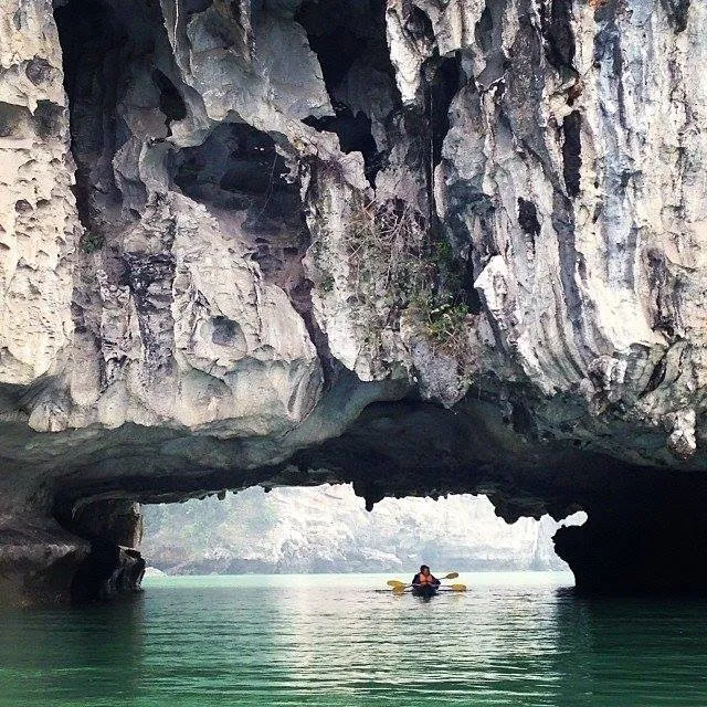
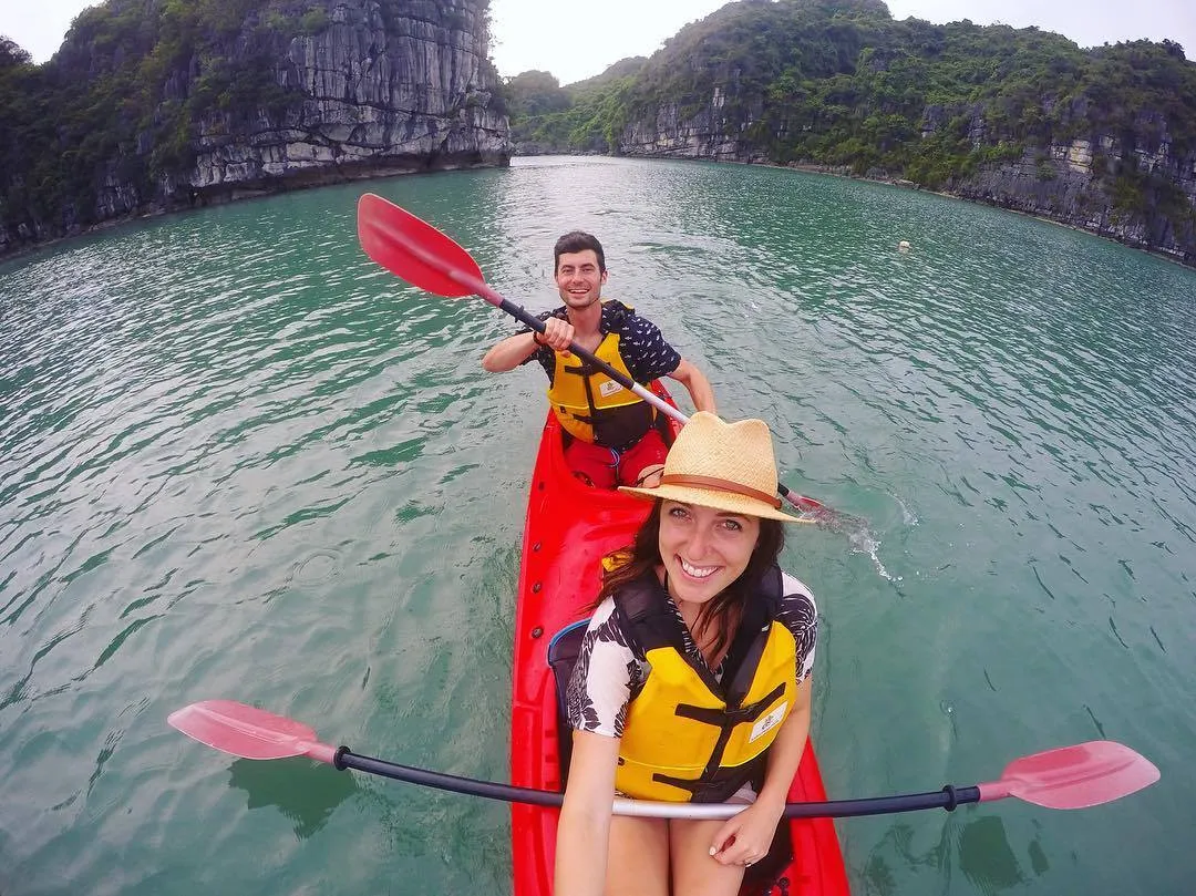
Kayaking Maps: Designated Areas and Routes for Paddling
For visitors seeking more active exploration, kayaking maps highlight suitable areas and routes for paddling adventures in Ha Long Bay. While dedicated kayaking maps may be less common than general tourist maps, information about kayaking locations is often integrated into broader tourism resources.
Popular Kayaking Locations
Several areas are consistently recommended for kayaking:
-
Lan Ha Bay: Often cited as a quieter, less crowded alternative to the main Ha Long Bay area, offering peaceful paddling experiences
-
Dark and Bright Cave (Hang Toi and Hang Sang): A cave system leading to an open-air lagoon, best explored by kayak
-
Ba Trai Dao Islands: A cluster of three islands with pristine beaches, excellent for kayaking when weather permits
-
Tra Bau Area: Known for clear waters and tranquil scenery, a good spot for kayaking
-
Frog Pond Area (Ao Ech): A serene location with clear waters and greenery, offering unique kayaking adventures
-
Tung Sau Pearl Farm: A quiet area suitable for kayaking while also introducing the pearl cultivation process
-
Luon Cave: A water tunnel leading to a peaceful lagoon, often explored by kayak or small bamboo boat
-
Ba Ham Area: A series of interconnected lagoons accessible through underwater caves by kayak during low tide
Kayaking maps outline the best spots and routes for paddlers looking to explore the bay up close - Photo Source: Facebook Vịnh Hạ Long Quảng Ninh - Thiên Đường Cảnh Vịnh
Kayaking Map Features
When available, specialized kayaking maps typically include:
-
Difficulty ratings for different routes
-
Approximate paddling times between locations
-
Tide-dependent access points (some caves and passages are only accessible at certain tide levels)
-
Areas with notable marine life or unique geological features
-
Sheltered areas recommended for beginners
The repeated emphasis on Lan Ha Bay as a premier kayaking destination across multiple sources suggests a growing interest in less crowded experiences within the greater Ha Long Bay region. Kayaking maps, whether standalone or integrated into broader tourism resources, provide valuable guidance for visitors seeking more active and immersive exploration options.
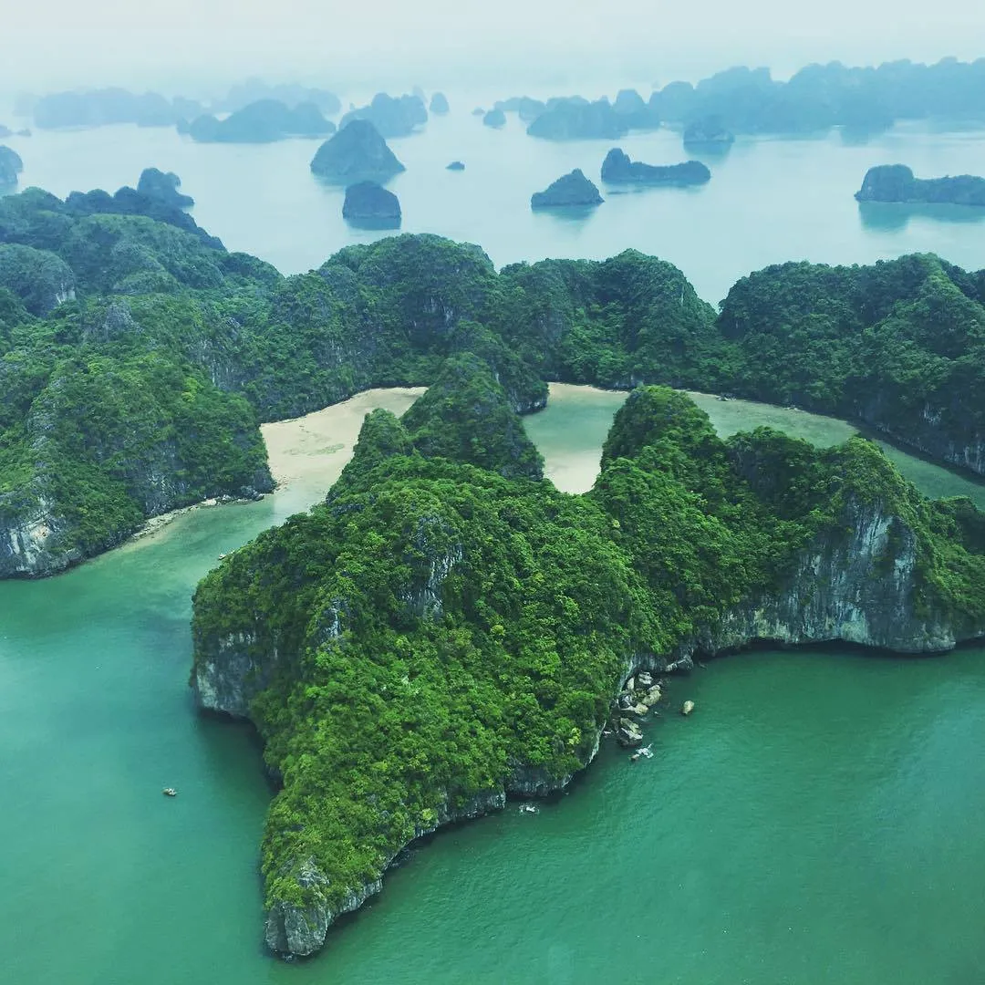
Island Maps: Identification and Location of Islands in the Bay
Given the extraordinary number of islands in Ha Long Bay—between 1,600 and nearly 2,000—maps focusing specifically on identifying and locating these formations serve an important purpose. Island maps vary in detail, from simple representations showing only the largest islands to more comprehensive charts cataloging a greater number of formations.
Key Islands and Features
Major islands consistently featured on maps include:
-
Cat Ba Island: Though administratively part of Hai Phong, it's geographically connected to the Ha Long Bay ecosystem and frequently included in broader maps
-
Tuan Chau Island: A developed island serving as a gateway to Ha Long Bay
-
Ti Top Island: Popular for its beach and viewpoint
-
Bo Hon Island: Home to several famous caves including Sung Sot Cave
-
Dau Be Island: Known for its biodiversity and lagoons
-
Ga Choi Island (Fighting Cocks Island): A distinctive formation resembling roosters that has become an iconic symbol of Ha Long Bay
Island Classification
Some more detailed island maps categorize islands based on:
-
Inhabited vs. uninhabited
-
Presence of beaches
-
Accessibility for tourism
-
Notable geological features
-
Presence of caves or grottos
While the total number of islands is consistently reported between 1,600 and 2,000, most maps name only a small fraction of these, suggesting that while the limestone karst landscape as a whole defines Ha Long Bay's character, only a relatively small number of islands serve as significant tourist destinations or have recognized names.
Specialized Maps for Different Visitor Interests
Beyond the general categories discussed above, various specialized maps cater to visitors with specific interests in Ha Long Bay:
Cave Exploration Maps
For visitors particularly interested in Ha Long Bay's remarkable cave systems, specialized cave maps provide:
-
Detailed layouts of major caves like Sung Sot, Dau Go, and Thien Cung
-
Information about stalactite and stalagmite formations
-
Lighting features and walkway routes
-
Historical or cultural significance of different chambers
-
Accessibility information

Island maps help identify and locate key islands within Ha Long Bay’s thousands of formations - Photo Source: Facebook Vịnh Hạ Long Quảng Ninh - Thiên Đường Cảnh Vịnh
Cultural Heritage Maps
These maps focus on the human history and cultural significance of Ha Long Bay, highlighting:
-
Floating fishing villages like Cua Van and Vung Vieng
-
Archaeological sites dating back to prehistoric periods
-
Historical sites related to Vietnam's struggles against foreign invaders
-
Local cultural practices and traditions
-
Craft demonstration locations
Geological Interest Maps
For visitors fascinated by Ha Long Bay's unique geological formations, specialized maps feature:
-
Areas with distinctive karst features
-
Explanations of geological processes that formed the bay
-
Sites showing evidence of sea level changes over millennia
-
Notable fossil locations
-
Areas demonstrating different stages of limestone erosion
These specialized maps enhance the experience for visitors with particular interests, allowing them to delve deeper into specific aspects of Ha Long Bay's natural and cultural heritage.
Practical Guide to Using Ha Long Bay Maps
Having examined the various types of maps available, here are practical tips for using them effectively to enhance your Ha Long Bay experience:
Before Your Trip
-
Start with a general map to understand the overall geography and scale of Ha Long Bay
-
Consult cruise route maps when selecting your tour to ensure it covers the attractions that interest you most
-
Study tourist maps to prioritize which attractions you most want to see in case time is limited
-
Download interactive maps to your mobile device before departure, as internet connectivity may be limited on the bay
-
Cross-reference multiple map sources to gain a comprehensive understanding, as different maps may emphasize different features
During Your Cruise
-
Use your map to track your journey, identifying landmarks as you pass them
-
Refer to detailed cave or island maps before each stop to know what to look for, addtionally, make sure to read previous tourist's review about the particular place (look for Dau Go cave history, Thien Cung Cave reviews, and mentions of Thien Canh Son Cave on travel blogs or mobile apps)
-
Consult kayaking maps if optional paddling excursions are offered
-
Share map information with fellow travelers to enhance group enjoyment and understanding
-
Mark personal discoveries on your map to create a personalized souvenir of your journey
For Independent Travelers
-
Combine multiple map types for a comprehensive self-guided experience
-
Use interactive maps to identify less-visited areas if seeking to avoid crowds
-
Verify current access conditions as some areas may have seasonal restrictions
-
Check tide tables when planning kayaking routes, as some passages are tide-dependent
-
Keep updated maps of port locations as embarkation points may change
Creating Your Personal Ha Long Bay Map Experience
One of the most rewarding approaches to Ha Long Bay exploration is creating your own personalized map experience:
Annotation and Journaling
Consider keeping a personal annotated map throughout your journey:
-
Mark particularly beautiful viewpoints you discover
-
Note exceptional wildlife sightings
-
Record personal reflections about different locations
-
Track weather and light conditions that created memorable scenes
Photography Mapping
Create a visual map of your journey:
-
Photograph distinctive limestone formations from different angles
-
Record sunset and sunrise locations
-
Document the changing colors and moods of the bay
-
Create panoramic images that capture the vast scale of the landscape
Personalize your journey with custom map notes, photos, and sustainability insights - Photo Source: Facebook Vịnh Hạ Long Quảng Ninh - Thiên Đường Cảnh Vịnh
Sustainability Notations
For environmentally conscious travelers, consider mapping:
-
Areas of pristine natural beauty versus more developed zones
-
Signs of environmental challenges or conservation efforts
-
Traditional sustainable practices in floating villages
-
Evidence of ecosystem recovery in protected areas
Conclusion
Maps in Ha Long Bay are more than just tools for getting around—they're keys to unlocking the bay’s stunning geography, hidden gems, and rich cultural layers. From general layout maps to detailed guides on caves, islands, and local life, each map reveals a different side of this UNESCO World Heritage site.
Given the bay's complex network of limestone karsts, caves, and floating villages, maps cater to a variety of travel styles—whether you’re cruising, kayaking, or exploring on foot. The right map not only helps you find your way but also deepens your appreciation of the natural and historical significance of what you're seeing.
Taking time to explore different maps before your journey ensures a smoother, more insightful adventure through this breathtaking seascape—where every island and waterway has a story to tell.
|
Joytime - Your Vietnam Journey's Servant Expert Follow us for travel tips, local insights, and exclusive offers:
|